Coastal Intelligence For Every Community
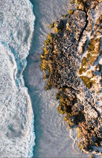
RCOAST flies your coast in every season to get a full picture of your coastal change and measure which interventions actually work.

Communities invest billions in coastal mitigation annually without knowing which interventions work.
Spending lacks feedback loops, performance metrics, and evidence of ecological benefit—leaving billions misallocated and millions at risk.
How RCOAST Helps Your Community
RCOAST delivers 4D coastal intelligence that shows your coastal health in easily understood formats so you can optimize your coastal interventions.
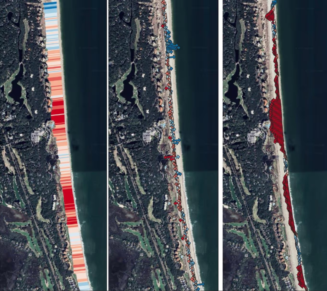
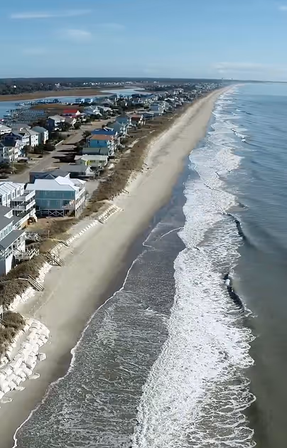
Know Every Detail Of Your Coastline
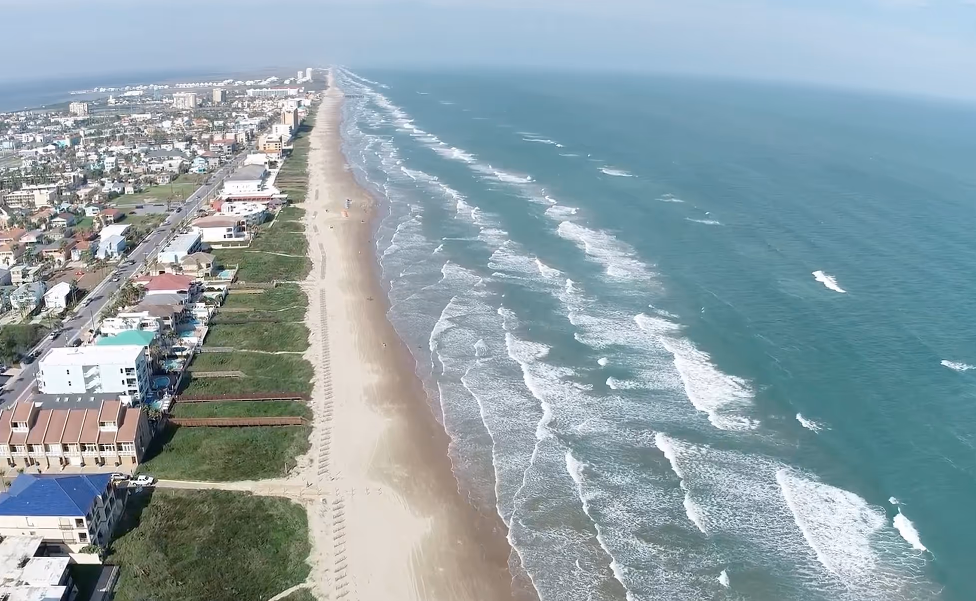
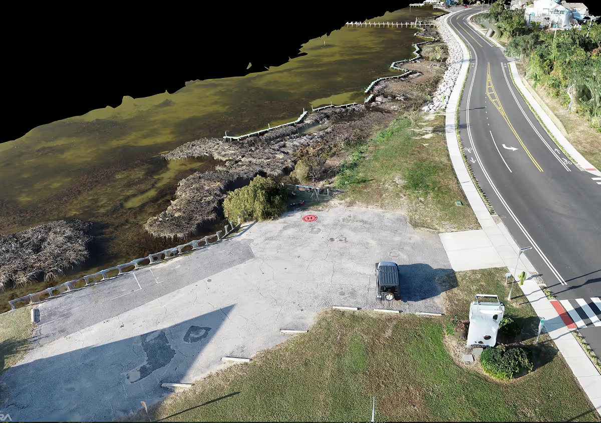
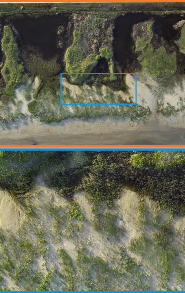
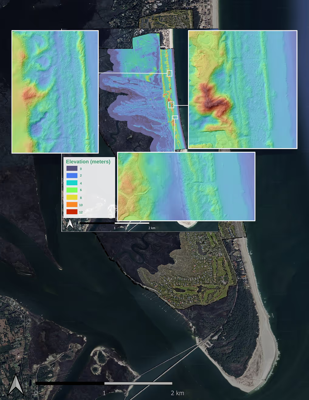
Drones and small aircraft equipped with LiDAR and multispectral imaging capture your coastline in precise detail.
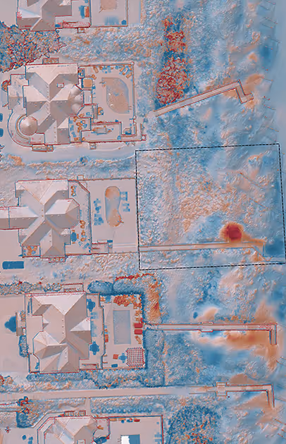
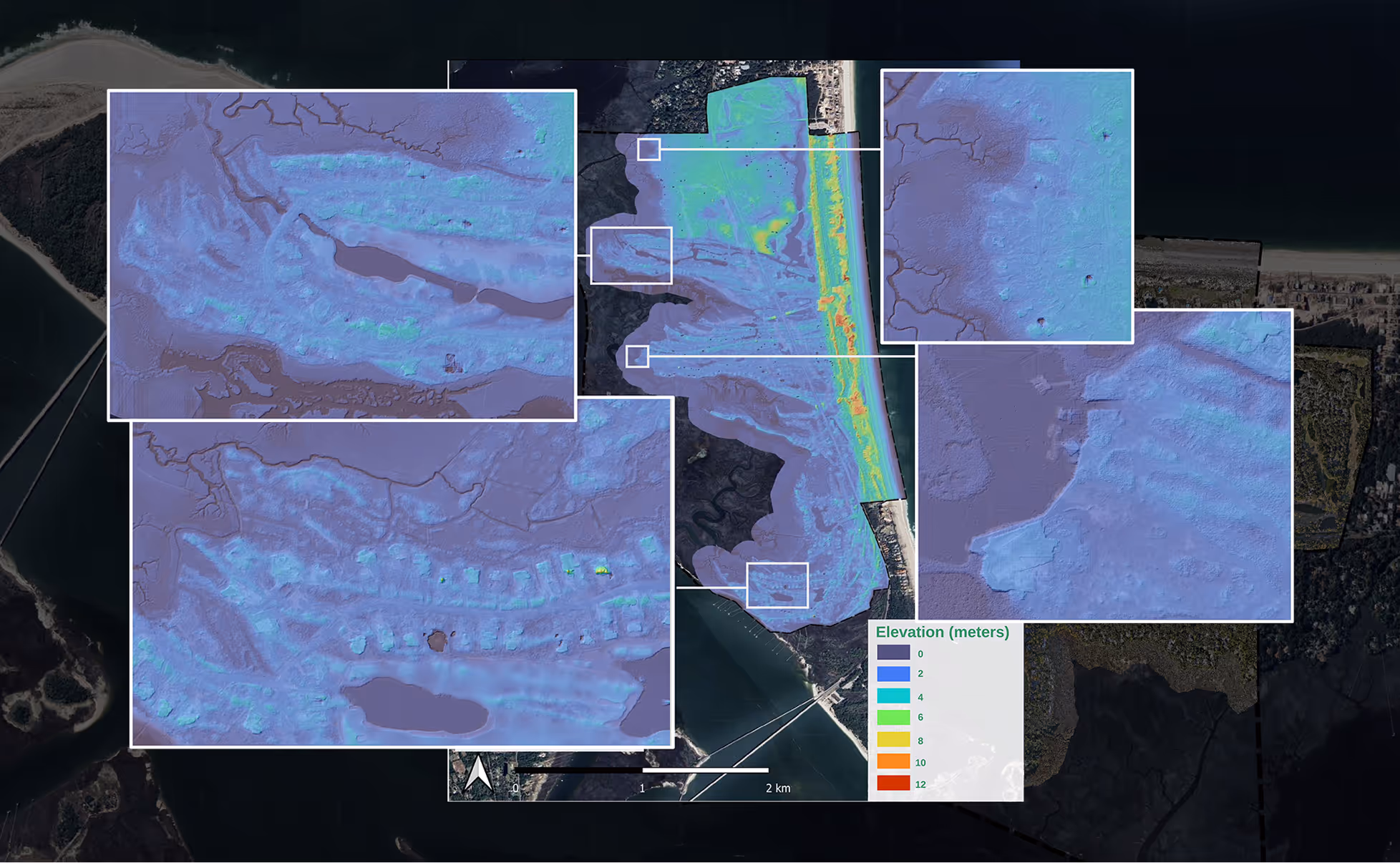
Data That Makes Sense to Everyone
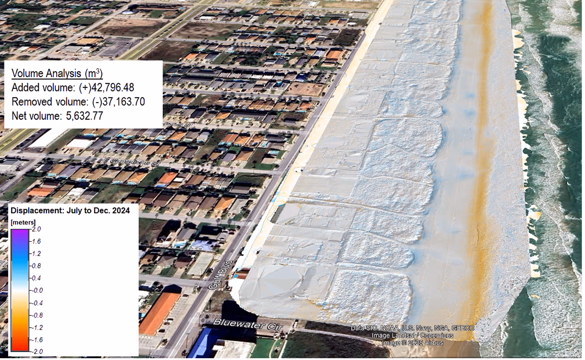
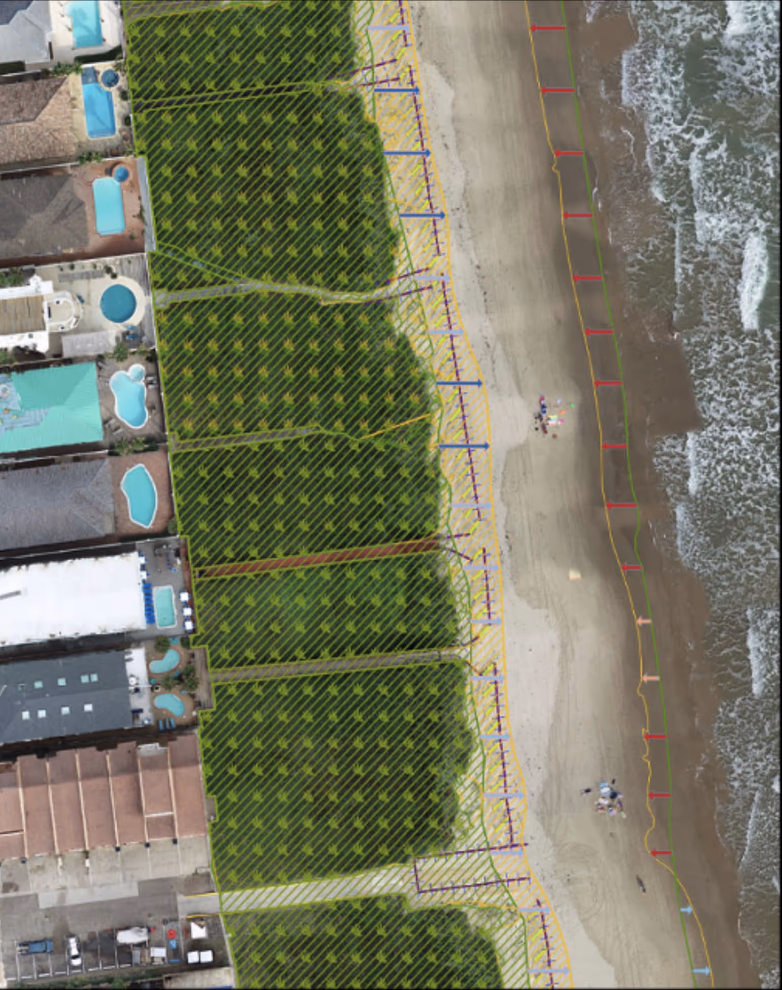
LiDAR, multispectral imaging, and machine learning transform raw coastal data into maps, performance scores, and predictions any manager can use immediately.
Optimize your Coastal Spend ROI
Ongoing tracking of your coastal mitigation efforts to see what is effective for your coast. Optimize spend and scale what works.
A Global Network Where Communities Learn from Each Other's Successes
Lessons from a living shoreline in North Carolina shape decisions in Portugal. Communities learn from each other's successes and failures, with real cost comparisons and ROI drawn from similar environments worldwide based on the specifics of your local data.


RCOAST by the numbers
Communities worldwide trust RCOAST to monitor their coastlines and measure what works. Here's what we've accomplished together.
Communities served
acres monitored
drone scans

.avif)
See How RCOAST Helps Communities
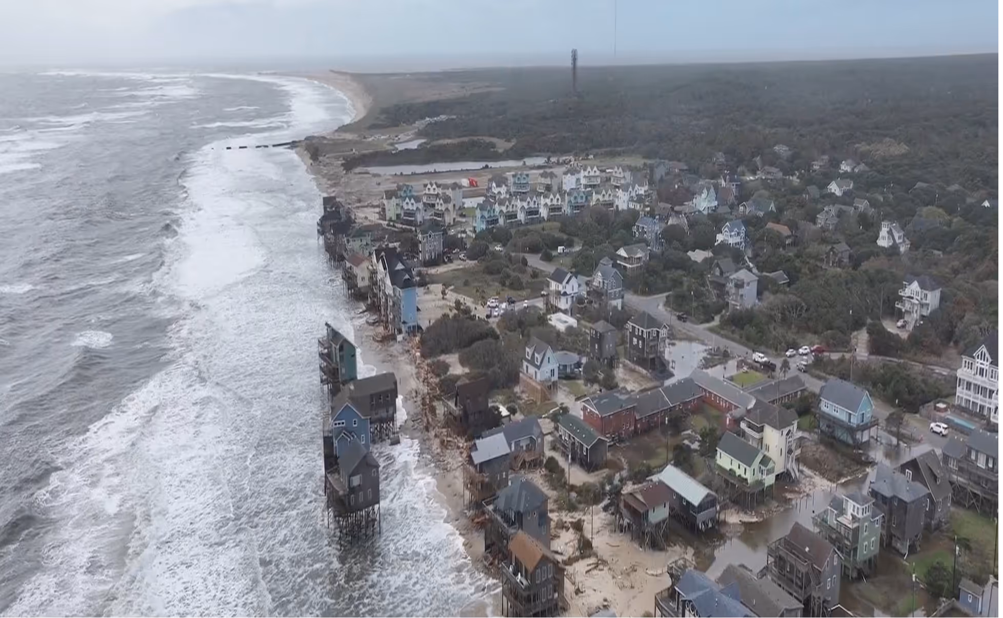
Aerial platforms capture real-time coastal conditions across documented projects, artificial intelligence analyzes data from specific scenarios, and you gain the knowledge to respond to similar situations.
-min.jpg)
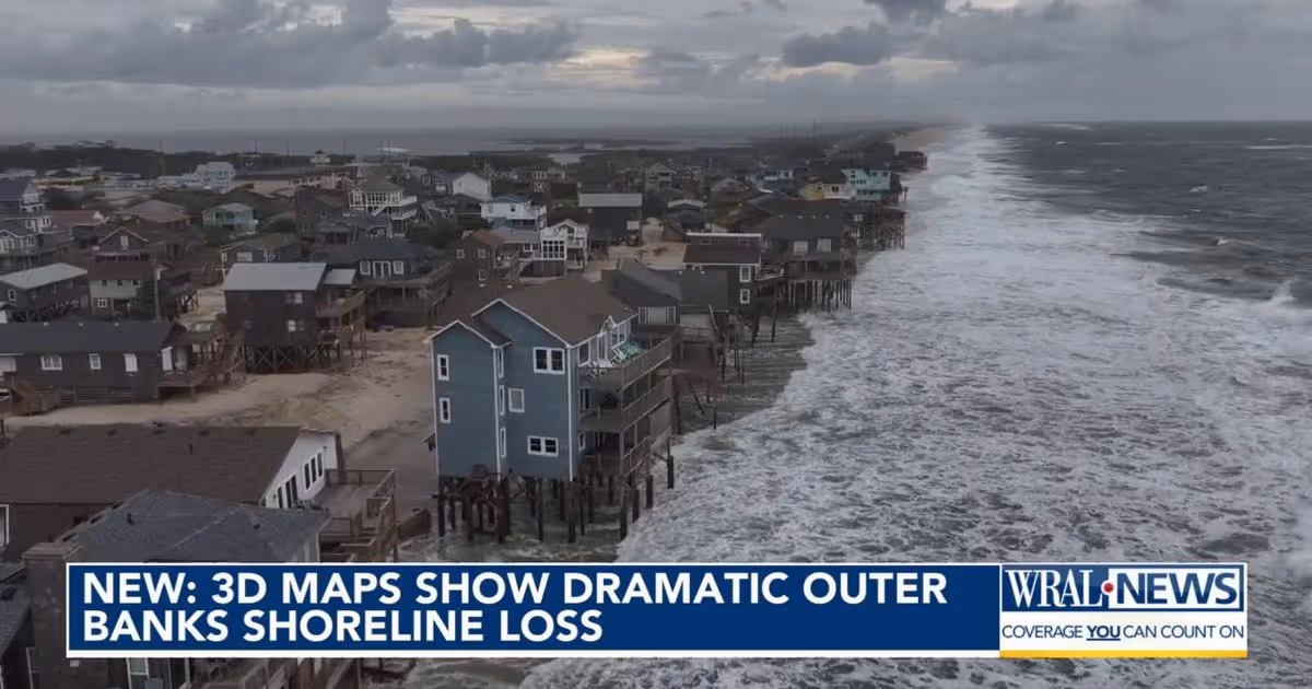
RCOAST in the news
Real data. Real solutions. Real impact on coastlines.

-min.jpg)
Ready to protect your coastline today?
Join communities worldwide using RCOAST to monitor and measure what works.